Monatsarchiv: April 2010

Rindo Exploration in Chichibu

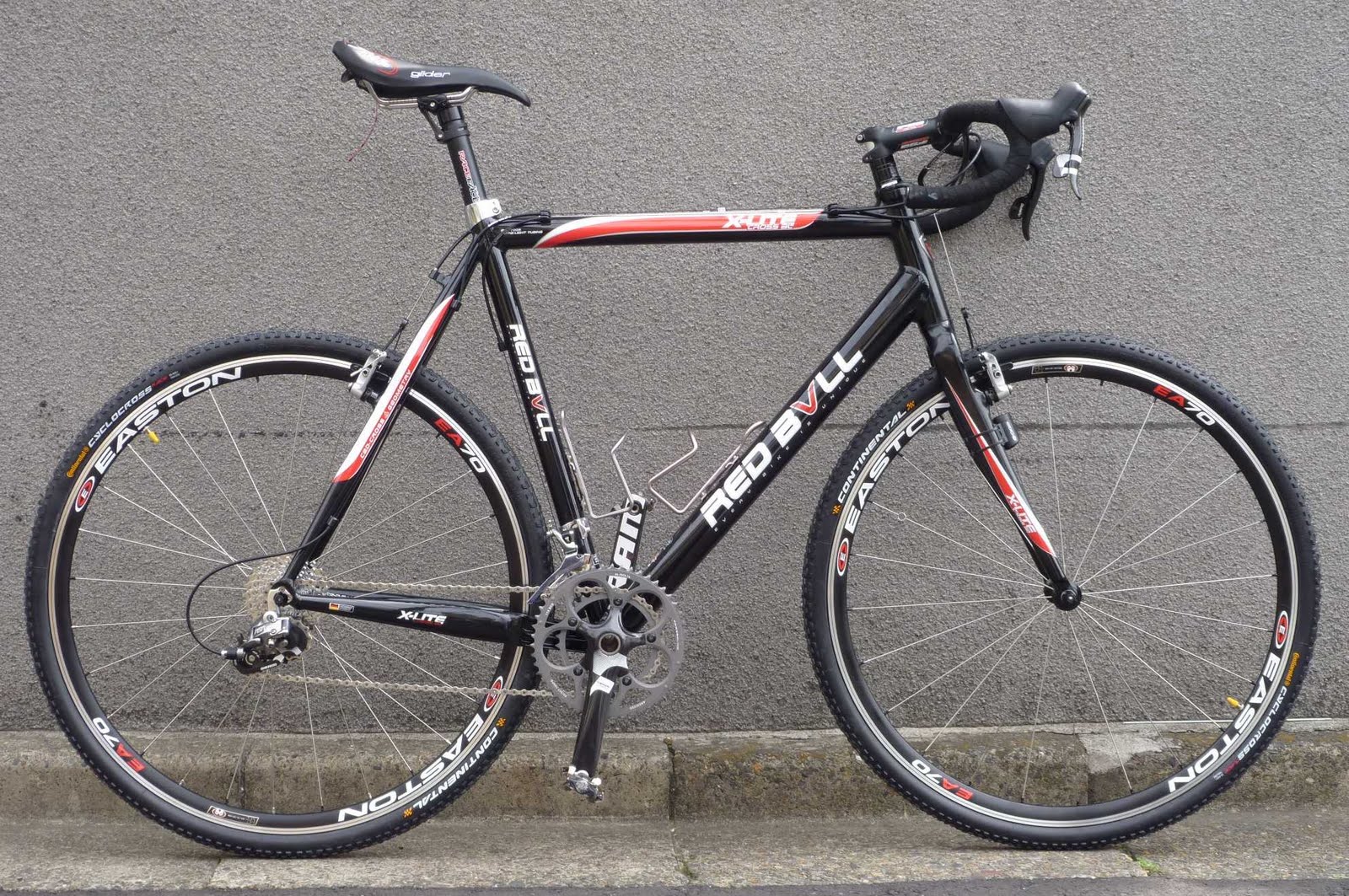
The forth weekend in succession on which I explored rindos with my new cyclocross bike. This time, I headed for Chichibu.

Despite a particularly early start, leaving home at 5:45am, the Tamagawa was already crowded with people. And not because of the cherry blossom in many places – actually these were the most deserted parts.
I noticed quickly that I was still not fully back in form, having been down for two days with a virus mid-week. I had difficulty pushing my heart rate above 150 – or rather, I didn’t even feel like trying. But cycling at moderate speed (not made better by significant head wind) was still fun, so I kept going.
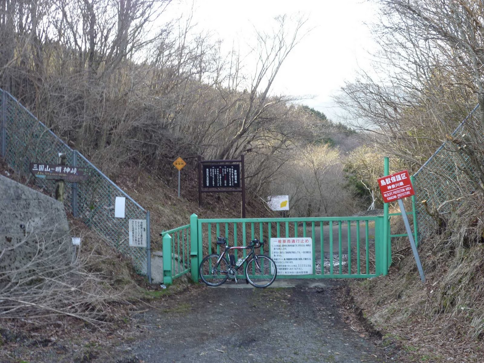
I explored a new route onto the Green Line (see GPS trail below), going from Ome to just before Hanno, then turning up the Irumakawa valley, turning into the valley leading towards Nennogongen, but taking the first rindo turning off to the right and over a 300m pass down to Higashi-Agano (on route 299). Route 299 was full of nasty truck traffic as usual, but I only had to cycle 200m upward on the pavement before turning off to the right into a nice valley and then rindo leading up to Kouburi Toge (500m), the start of the Green Line. From there the rindo continues as everybody knows over various „passes“ reaching up to 900m.
It was nice climbing with little traffic. The sun had finally come out, and I found myself overdressed in what was still basically winter gear.
At Ono Toge, instead of turning right as we always do towards Shiraishi Toge and Sadamine Toge, I left the Green Line to the left, heading towards Kenminnomori. Saitama needs its forest just as Tokyo needs their own (Tominnomori). This rindo was also well paved, and easily accessible by road bike. In fact, I saw a group of riders who must have made it up from Chichibu city.
Instead of turning down towards the city, I kept going, passing by a camp side protected by a friendly guard man, direction of Nagatoro. Beyond the camp side, the rindo falls down steeply, first unpaved (but in decent condition so manageable even on a road bike), then paved. My hands became quite tired from all the breaking, so steep and long was the descent. At one point, I got off to check the heat of the wheel rims, and almost burnt my hands. I felt the rubber melting and losing grip. The paved surface was rather uneven, so I couldn’t go faster than 30km. What a waste of mass! I prefer to spend accumulated altitude on a fast downhill!

At the foot of Sadamine Toge, I turned north, passing the Nagatoro gorge on its right. People were enjoying the by now really beautiful spring weather going through the gorge in boats.
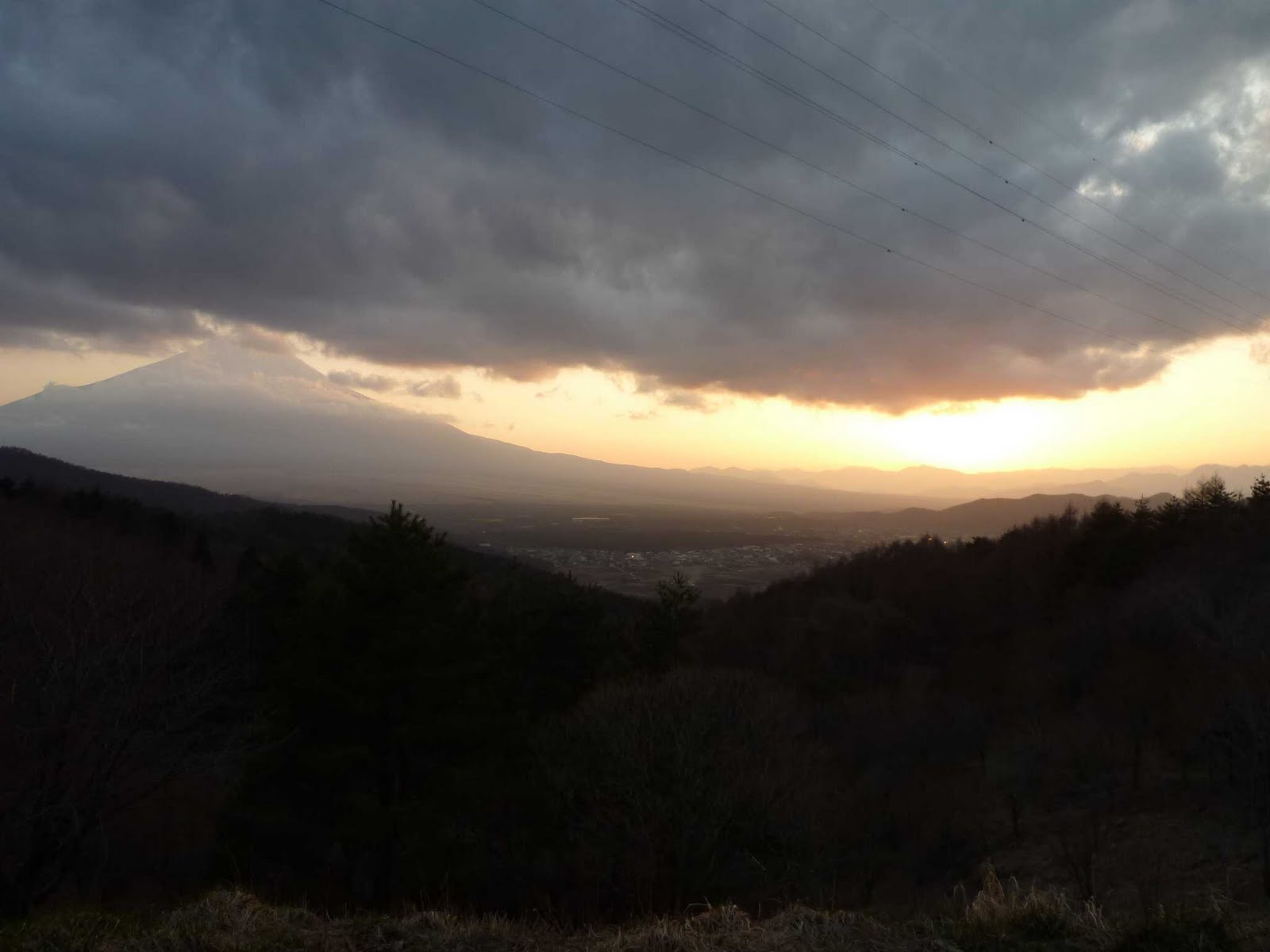
Lots of nice photo opportunities, of landscape and also a lot more cherry trees. Every stop made me realise that I was really not in great shape – I felt the exhaustion even though I had not really pushed myself that hard. At a 7-11 stop in Nogami, I decided it was best to take the shortest route to Honjo-Waseda and spend the rest of the afternoon resting at home, perhaps getting in shape to head out with the PE crew the next day. I had rewarded myself with an onigiri and Black Thunder, when I was approached by an older woman offering me another rice ball that she and her husband had left over. I took it gladly, and it was delicious, a lot more so than the usual 7-11 variety. It looked home-made.
The guilt of the extra calories convinced me to keep going – for another round into the mountains. My plan was to head over to the Shimokubo dam lake and take the rindo leading from there to Shiozawa Toge, then run down to Tomioka.
All worked well until I missed a turn into a rindo that was meant to take me down to the dam, and instead kept going upwards on a rindo that was running parallel to the lake on its south side. I realised the mistake only 50 altitude meters or so after the turn, but decided this one was also worth exploration. The rindo keeps rising ultimately up to 980m, and then leads on in various ups and downs around the ridge of the mountain range to Tsuchizaka Toge at 700m, one of the many passes from Chichibu into Gunma which I have taken before.
Down in Gunma, I was tempted to climb up to that other rindo and cycled up to the entrance of the road, but then decided to be reasonable for a change and not attempt another 650m climb in my condition. Better take the road straight to Honjo, or so I thought. Least did I know that I still had quite some climbing ahead of me. As it turns out, (according to mapmyride) I would have had only another 200m to climb and no difference in distance at all, had I gone up that mountain…
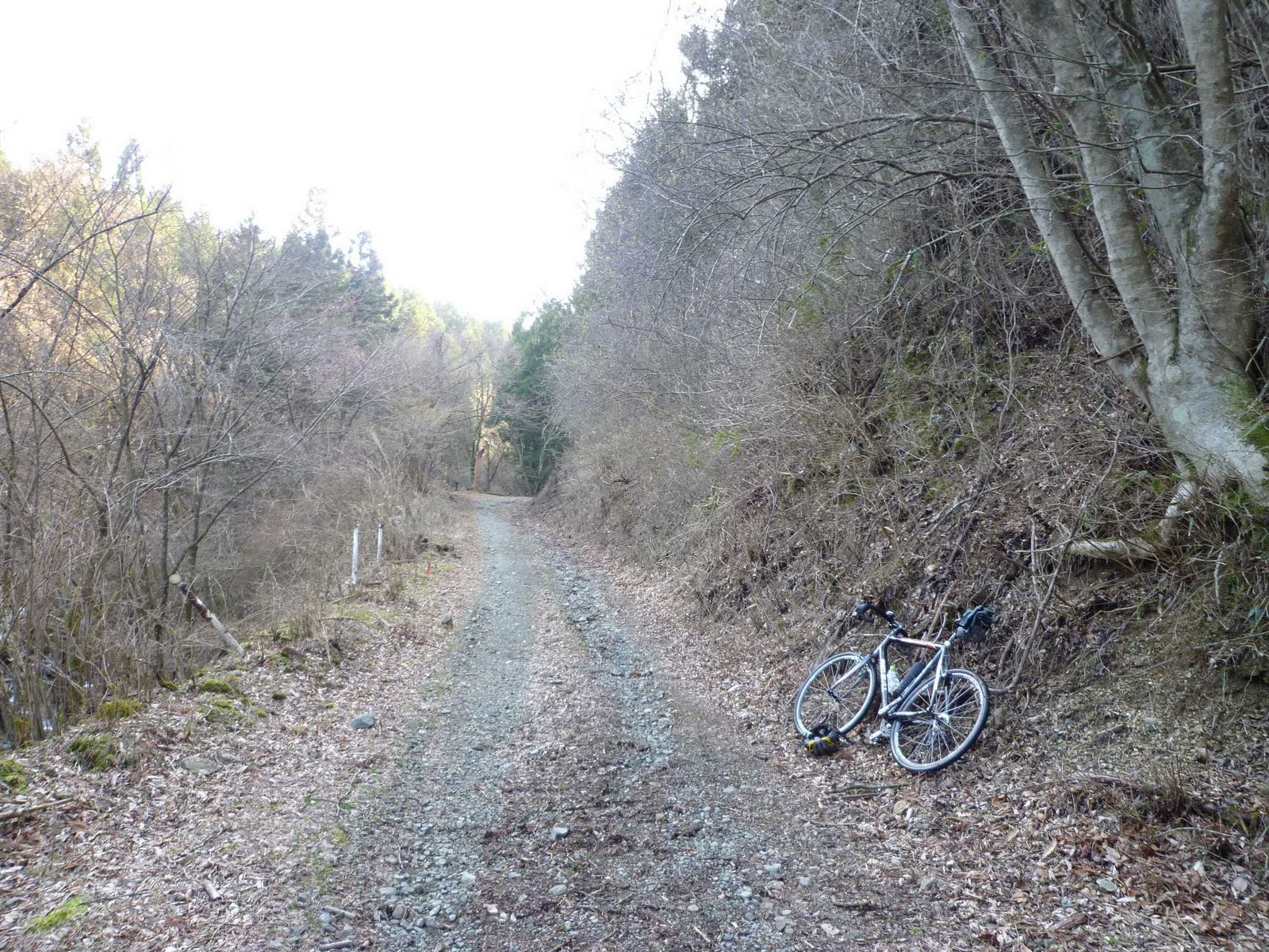
I took route 462 along the valley towards the lake. Traffic was moderate, but rather too many noisy motor bike groups for my taste. So I left 462 to take what is essentially a badly maintained rindo, running on the other (south) side of the lake. Unlike the kokudo though, it runs deeply into some of the valleys running into the lake, and has several climbs of up to 150m each.
I passed by a nice natural fountain and replenished my water supply. Less nice about it was the fact that somebody had dumped their sodaigomi in front of it. Unfortunately, the rindos in this area were full of such sights/sites. Unbelievable that people ship their trash out into the mountains instead of paying a few hundred yen to have it collected.
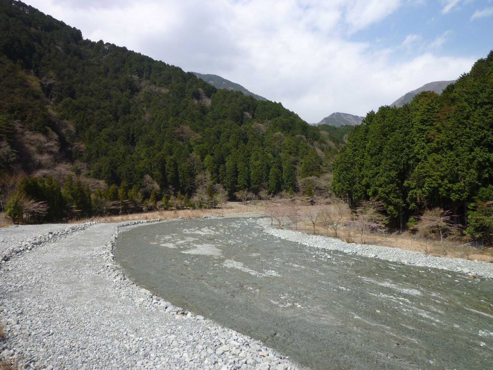
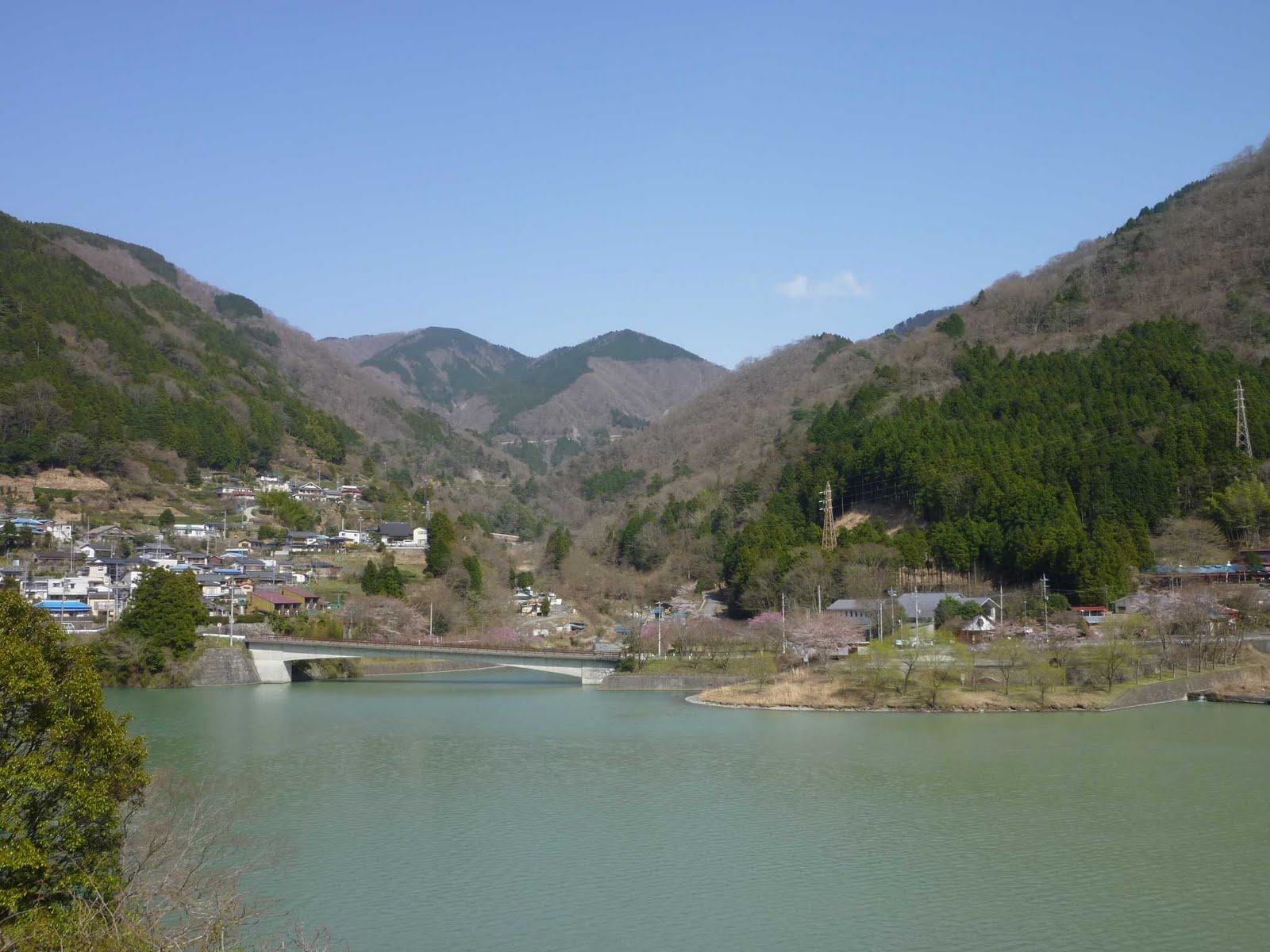
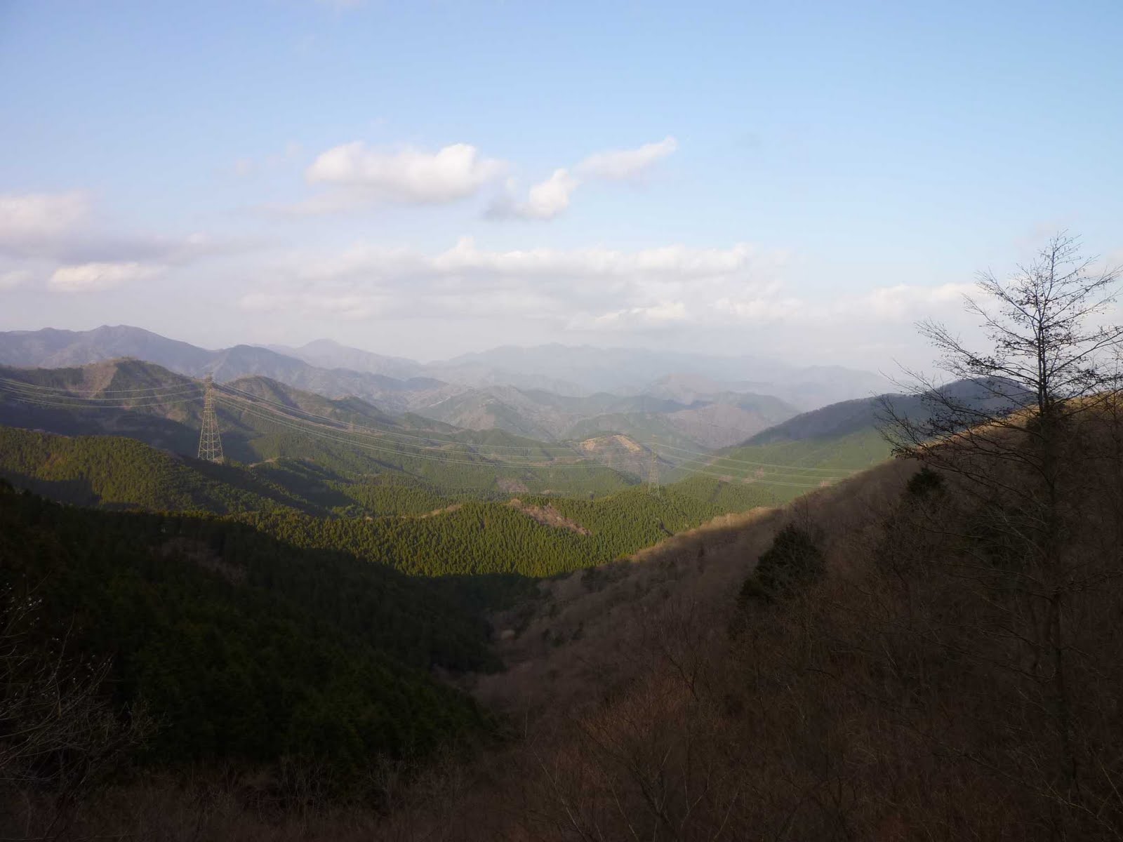
Such sorrow sights were compensated by plenty of stunning views of the lake and its small islets.
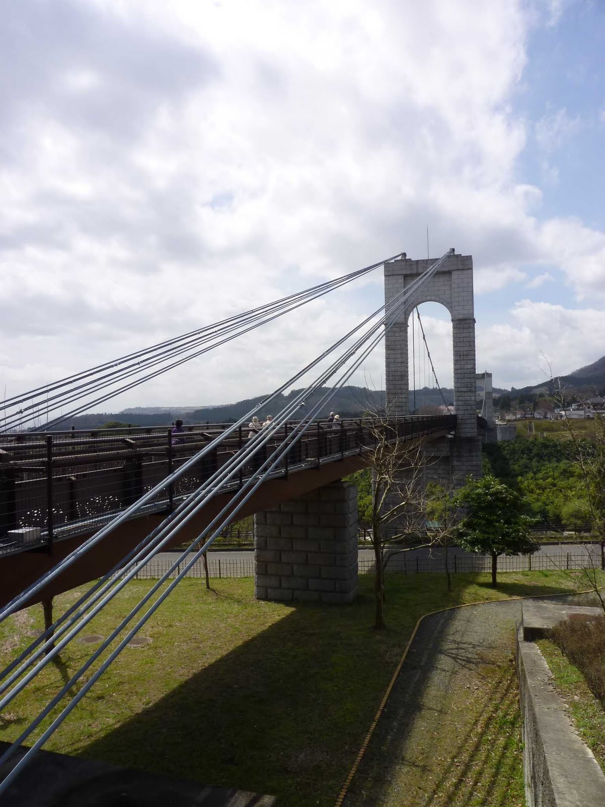
The dam wall looks like the fortress walls of a Japanese castle.
Beyond the dam, I thought it was all just a straight downhill into the village at the bottom of the valley and then a fast run to the station. None of it – more up and downs! And a landslide that blocked the entire road – an invitation to the cyclocrosser to walk over it!
Then another building site – road blocked to traffic! Well, when has that ever been an obstacle? This time, however, there was a huge gap in the road, with a five meter cliff straight down. Building workers busy with their work, and not noticing the sole cyclist towering over them.
I thought it was pointless calling their attention as this would just risk them telling me to get lost from where I had come. Instead, I worked myself up a steep hill, through grass and bushes, and then down again, right into the building site, to the utter surprise of one of the workers, who was so speechless, he couldn’t say anything. Which was just as well, so I could get on speedily.
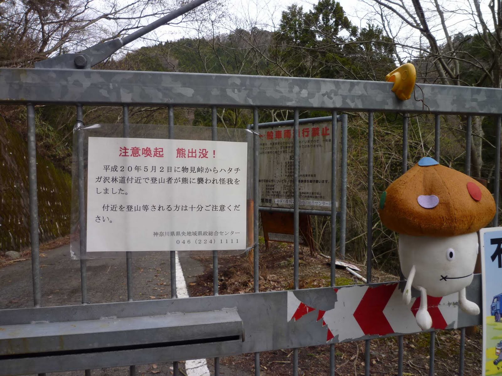
The remaining barrier of the day was one for a bird rather than myself. A young prey bird had got trapped behind the fence securing a wall of rocks along the rindo.
I managed to secure a larger whole at the bottom of the fence by inserting between fence and rock a PET bottle from another one of those trash dumps right opposite. The bird had fled my help attempts to the upper parts of the fence, and I can only hope it eventually found its way out.
I myself found my way to the station rather easily, this time avoiding route 462 altogether, and going to Honjo rather than Honjo-Waseda. A Takasaki-Hiratsuka direct train took me to Shinjuku in just one go (and 1.5 hours).
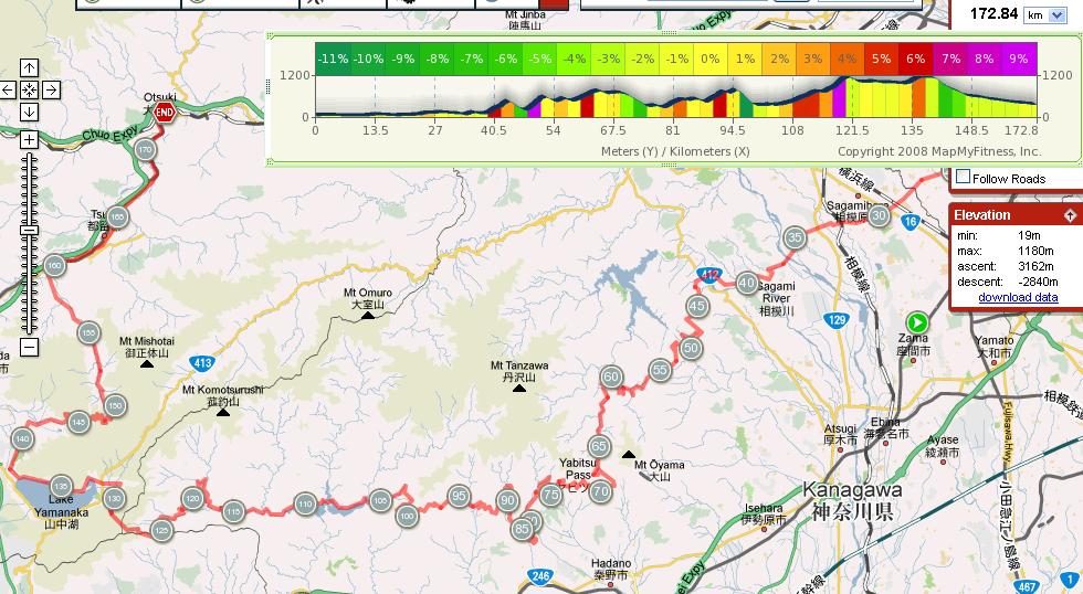
185km with 2,800m BBiT in altitude gain. 11.5 hours on the road, of which 8.5 on the bike – i.e. I had taken it rather easy.

2 Kommentare

Eingeordnet unter 2010

Paris-Roubaix a.k.a Hell of the North


There is an interesting piece on Simon Lamb’s excellent site La Gazzetta della Bici on this classic race which happens this weekend.


A couple of highlights – one very moving to me (the 2nd one in case you wonder):

“It’s a bollocks, this race!” said de Rooij. “You’re working like an animal, you don’t have time to piss, you wet your pants. You’re riding in mud like this, you’re slipping … it’s a pile of shit.”

When then asked if he would start the race again, de Rooij replied:
“Sure, it’s the most beautiful race in the world!”


Hell of the North
The race usually leaves riders caked in mud and grit, from the cobbled roads and rutted tracks of northern France’s former coal-mining region. However, this is not how this race earned the name l’enfer du Nord, or Hell of the North. The term was used to describe the route of the race after World War I. Organisers and journalists set off from Paris in 1919 to see how much of the route had survived four years of shelling and trench warfare.Procycling reported:

They knew little of the permanent effects of the war. Nine million had died and France lost more than any. But, as elsewhere, news was scant. Who even knew if there was still a road to Roubaix? If Roubaix was still there? The car of organisers and journalists made its way along the route those first riders had gone. And at first all looked well. There was destruction and there was poverty and there was a strange shortage of men. But France had survived. But then, as they neared the north, the air began to reek of broken drains, raw sewage and the stench of rotting cattle. Trees which had begun to look forward to spring became instead blackened, ragged stumps, their twisted branches pushed to the sky like the crippled arms of a dying man. Everywhere was mud. Nobody knows who first described it as ‚hell‘, but there was no better word. And that’s how it appeared next day in the papers: that little party had seen ‚the hell of the north.‘

The words in L’Auto were:
We enter into the centre of the battlefield. There’s not a tree, everything is flattened! Not a square metre that has not been hurled upside down. There’s one shell hole after another. The only things that stand out in this churned earth are the crosses with their ribbons in blue, white and red. It is hell! ‚
“ This wasn’t a race. It was a pilgrimage. ”
Henri Pélissier, speaking of his 1919 victory.


Nowadays riders have special bikes for these Spring Classics. Who needs more than this??


Ein Kommentar

Eingeordnet unter Uncategorized

Sunday Ride — Route TBD

Jerome and I will be leaving my house (let’s call it the corner of Komazawa Dori and Kanpachi Dori) at 6:30AM.  We will pick up anyone who wants to join at Tamagawahara-bashi at 7:00AM.

The route thereafter is open to debate and depends somewhat on who joins, on the weather forecast (rain Sunday night … or starting before our return time in the afternoon?) and any individual time limitations.  But make no mistake, it is prime training season and we are hoping for a classic Positivo Espresso ride.

My vote is for Matsuhime (1250 elev) from the North side, then the gated-off Northern approach to O-Toge (1500 meters) and quick drop down to Otsuki … but I could be persuaded to do just about anything other than Yanagisawa Pass, which we just did last weekend.  I could probably be persuaded to do even Yanagisawa again — they’ve got two newly opened sky bridges so the descent to Enzan is even faster than before.

Please show up and get ready to make a persuasive case for your favorite* ride!

*Must be within day-trip distance of Tokyo.

9 Kommentare

Eingeordnet unter 2010, David, Jerome

Beyond the Peloton : Milan – San Remo 2010

A new video from the Cervelo series. Perhaps not as good as the 2009 videos, but still better than almost everything else about cycling on the web.

I liked the picture of the Cervelo rider in the typical flat lands of Belgium; so similar to my home town. And so much closer as well.

Hinterlasse einen Kommentar

Eingeordnet unter 2010, Cervelo Soloist, Mob

Ekiden 2 point 0

http://vimeo.com/moogaloop.swf?clip_id=10529044&server=vimeo.com&show_title=0&show_byline=0&show_portrait=0&color=00ADEF&fullscreen=1

Wolfpack Hustle crashed the LA Marathon by hosting an underground bike race on the closed marathon course at 4 am. A once a year opportunity to race 26 miles of Los Angeles with no traffic.“

Ein Kommentar

Eingeordnet unter Uncategorized

Cycle lane

„At little more than the length of a single bicycle, the £2,000 road marking has left cyclists in Cardiff bemused.

The feature, thought to be the shortest cycle lane in Britain, has been installed to encourage green transport.

Cardiff Council claims that it will help riders safely navigate a turn on a new road layout.

But riders in the city say the brevity of the red and white marked stretch of road renders it pointless.

Kevin Hughes, 47, a cyclist from the Welsh city, said: „It’s just hilarious. I saw it as I was cycling past and couldn’t believe my eyes.

„Obviously nobody could cycle in it because it is so small. You just have time to get in the saddle before getting off again.“

A Cardiff Council spokesman said the lane is intended to „highlight the interface between the eastbound carriageway and the beginning of a new contraflow facility“.

He said it would help cyclists cross the busy city centre and give them somewhere safe to stop before turning.

He said: „The purpose of the new facility is to enable cyclists to ride safely and legally in the opposite direction to the flow of traffic.

„The marking helps to highlight the point at which cyclists can turn left off the carriageway to join the contraflow facility.““

Council condemned over ‚Britain’s shortest cycle lane‘ – Telegraph

Surprisingly this does not appear to be an April fool’s joke. 

Hinterlasse einen Kommentar

Eingeordnet unter Uncategorized

Cold Spring Training

Hope this can be edited into a more memorable blog entry later, but for now a simple trip report, to add to the others from this active training weekend.  Everyone is gettin‘ in shape!

Sunday was cold, more like January/February than April. Jerome, Michael K. and I had a great classic ride–leaving my house at 7AM, meeting Michael at Tamagawahara-bashi at 7:30 (well, 7:31), arriving at Aurore in Oume just after 8:30 for our first rest stop, then the long climb up Rte 411 to Yanagisawa Pass, a quick hot food stop (for me, add 20 minutes for Michael and Jerome as they waited in the warm restaurant) at the Pass. We were glad to be at the high point of the ride (1475 meters) between Noon and 1PM, slightly less bone chilling than would otherwise be the case.

In 20 minutes we were down to the Fruit Line just above Enzan, for some brief sunshine and a hint of warmth. We took that road (a series of rollers between 450 and 525 meters elevation) around the edge of the valley, toward the South, then climbed back up Rte 20 (Koshu Kaido) to the turn off for old Sasago Pass. One more climb up to 1095 meters, through the haunted pass tunnel, in the clouds and clammy cold as the ghosts reached out to us. Was the old lady wandering the deserted path, asking each of us if we knew of a „yadoya“ (old Japanese inn) up the path, really a ghost? We each answered „no“ or „I don’t know.“ What happens if you say „yes“ to this apparition?

Then a very fast trip down the hill to the main road and on to Otsuki, just in time to catch the 4:13 Azusa express to Hachioji (one stop, 30 minutes) and connections beyond for home.

All in all, a classic Positivo Espresso ride, just over 160 kms and 2500 meters of climbing.

Fortunately, we had Tom’s ride report from the previous day, (a similar ride, plus one even bigger pass and no train home, so maybe another 90 kms of riding and 1000-1500 meters of climbing!), and so were not surprised by the minor tree obstacles on Sasago Pass.

http://connect.garmin.com:80/activity/embed/28976978

4 Kommentare

Eingeordnet unter Uncategorized

The Wild Sheep Hunt

Yesterday, Tom rode the giant Yanagizawa Loop, consisting of the climbs to Yanagizawa, Kamihikawa, Sasago, Suzugane, Hinazuru und some other minor ones. Today, David, Jerome and me did the same loop. Almost.

Well, at least that was the plan, when the three remaining Positivo Espresso founding members gathered at Tamagawahara-Bashi at 7:30 AM. The (former) Tamagawa bicycle path, now a major walking path for the hanami-crazy, was full of people so we decided after a while to ride the normal road up to Ome.

Which brings me to the discussion about the Tamagawa path and the recently added obstacles (see for example here). Honestly, I don’t care. I don’t even want to put the argument forward that riding along the Tamagawa is boring and not very challenging and that I have been there a hundred times. Yes, all true but not of general interest. The point is, in my opinion, that the sum of total obstacles doesn’t increase too much, if some fixed obstacles are added to the enormous number of moving ones.

There were simply not that many people when I started to ride along the Tamagawa about ten years ago: people, people with dogs and bicycle riders on the path. It was a fast and simple way to get out of metropolitan Tokyo. But by now, this has changed dramatically: too many moving obstacles. Even if the speed bumbs will be removed, that wouldn’t change too much.

So, riding the (normal) road to Ome was comparatively much more pleasant and we were speeding towards our target like a fusillade of human bullets shot from an AK-47. Or perhaps more like a set of RPGs, given the shape of our bodies.

And so we arrived in Ome in 2 hours and 5 minutes – from my home in Yokohama that is. It cannot be done faster (today). And after a short break at Aurore bakery, we continued our fast ride towards Okutama and further up to the Okutama lake, without any longer breaks. This was the first time that I did the stretch between Ome and Yanagizawa in one go and as you can see on the right side this has now become the CHO TOGEBAKA (cho, in the double meaning of 長い and 超える), given the distance and elevation conquered. This is the mother of all Toge Baka (so far).

Now, when we made the turn at Okutama lake, Jerome was shouting from the top in front of me. Actually he told me, that we should wait for David who was further behind. But I didn’t understand that properly, plus I didn’t saw Jerome waiting, so I was assuming that he would be still riding in front of me. Now, as I don’t wanted to be beaten up Yanagizawa, I accelerated and went quickly around the lake, supported by a nice tailwind. No sign of Jerome. „Jesus“, I thought „He must be in really good shape.“ So I tried harder and exhausted myself completely on the climb. No Jerome came into sight. I had this vision that I was so slow, that David would overtake me with double my speed from behind.

So I run up Yanagizawa at full speed; until 200 elevation meters before the pass when I finally was convinced that Jerome must have been behind me. And I had run out of power. The climbing started to become really, really hard after being in the saddle for almost three hours. All the houses up there are deserted and all the curves looked alike and finally, well, there was the final one and I arrived at the restaurant on the pass which was also luckily opened. Jerome wasn’t there.

I had a bowl of Soba, when Jerome arrived about 10 minutes later. We waited for David, who joined us after further 30 minutes, looking pretty wet and exhausted. In the moment he entered the restaurant, Jerome and me got up from our chairs in good, old Positivo Espresso tradition and said „OK then, let’s go!“.

But the truth was, that I was also pretty much done and I wasn’t fully hydrated and recovered after some days of sickness last week.

So I made the following proposal: „We can do now Kamihikawa, Sasago, Susugane and Hinazuru, so about 34.786 meters (BBiT) of climbing plus an estimated 6.732 km (BBiM *) of distance, or we ride down to Ensan (now Koshu, by the way) and jump into an Onsen.“ Surprisingly enough, all of us opted for the Onsen visit, so we mounted our bikes and made the fast run down to Ensan. There it was pretty hot. The sky was blue, the thermometer showed 17 degrees and after all the cold weather before, we suddenly didn’t felt in the mood any longer to linger in hot water.

So we rode the Fruit Line to Route 20, climbed up again and then took a right turn up to the haunted Sasago tunnel. We took it really easy, at least David and me, while Jerome was frolicking around in faster speed-hemispheres.

Shortly before the gate we met a woman who asked us, if there would be an old hotel further up the road. No, only a haunted tunnel with transparent octopuses living in the vaults. Later David said, that we should have taken a photo of the women in order to check if her body and face would show-up on the print, then perhaps she was only an epiphany of a Fox deity.

The old Sasago Tunnel was filled to the ceiling with maximum horror as usual.

Here we can see David and Jerome, still not suspecting anything, while entering the tunnel from the Ensan side. And here we see David and Jerome and me coming out on the other side, after we have experienced pure terror in it’s most terrifying form in the darkness inside.On top of that there was also a strong wind and it was extremely cold inside the tunnel. And the weather on the Otsuki side of the tunnel was about 10 degrees colder than on the Ensan side.

So we made a fast run down to route 20 and almost froze to death. Then we made another superfast run down to Otsuki station on route 20 which was even more fun. And then we had a superfast express train from Otsuki home; all in all it took me less than 2 hours from arriving at Otsuki station to the door of my house.

A very nice trip with 167 km distance and more than 2.500 meter climbing (mapmyride checked). Could have been warmer, though. The last two rides (Chibchibu and this one) were some of the coldest rides ever. I enjoyed reading about the other rides on the weekend by Ludwig, Tom and the large PE group as well. It is good to know that so many activities are going on and there are so many groups to join.

Notes: I wrote this post yerstday after the ride, but didn’t had the time to edit it and include the photos. So, please take this as an addition to David’s post on the same subject.

(*) BBiM : Blind Believers in Me

Hinterlasse einen Kommentar

Eingeordnet unter 2010, Cervelo Soloist, David, Jerome, Mob

W.B. "Bill" Hurlow: The bicycle builder who sculpted his lugs and frames

Good to see a bicycle builder getting so much press, albeit only upon his death. Yesterday’s FT carried a long article on him, almost as long as the article on the Pope, filling the rest of the page on top.

Sound bites:

London-born Bill Hurlow was one of the world’s best-renowned and respected builders of lightweight racing bicycle frames, not just for racers but for bicycle fanatics, weekend riders and collectors across the globe who still treasure his creations. Described by many of his peers as „the Picasso of bicycle builders“, not just for his artistry but for the speed with which he plied his craft, Hurlow worked for most of Britain’s leading bike manufacturers after the second world war, when Britain was at the vanguard of bicycle making and set the standard for the rest of the world.

[…]

Among the customers for his bespoke models were rock star bike enthusiasts Mick Jagger and Eric Clapton, as well as actor Peter Sellers, who insisted his model be finished in Ferrari red to match his car.

[…]

Hurlow was an amateur racer himself, winning numerous time trial awards for two of the great cycling clubs of his day, Galena and Marlboro, including in the great Bath Road 100 (mile) time trial, in which he won the Lascelles Cup three times – in 1949, 1951 and 1952. He was still racing into his seventies, often beating competitors 30 years younger, and still covered 30-40 miles a day for pleasure into his mid-80s.

[…]

Hurlow’s designs influenced bicycle makers worldwide, particularly in the US, where frame builders took up his mantle and one described him as „the builder’s builder, a tailor of tubes“ for his ability to design and build a bike to individual measurements and needs – height, weight, build, and even, like a tailor, the vital inner leg measurement – to angle and balance the frame to suit the customer. „His bikes were the equivalent of Savile Row suits,“ said his friend and fellow biker John Hunt of Canterbury, Kent.

[…]

For many years, the Hurlow workshop in the mews of the White Horse pub in Herne Bay, Kent, was a mecca for would-be frame-builders, collectors or simply fans of his work from all over the world. One such visitor, American builder A.D. „Art“ Stump, who came to Britain to have Hurlow build a bike for him, said of his work: „I liken a well-designed lug frame to a good, engraved English shotgun. It doesn’t shoot any better than a plain shotgun, but it is pretty and shows the builder’s care in making it.“ Such was Hurlow’s reputation in the US that, after word of his death spread, bikers across the country hit the saddle for memorial rides in his honour.

Ein Kommentar

Eingeordnet unter 2010

Rindo Easter

After the virgin ride with MOB and another one with Tom (which both have blogged about), it was time to do my first solo ride with my new cyclocross bike, at my own pace.

I left home at 6am on Easter Saturday, taking Setagaya Dori and its extension all the way to Aikawa, situated at the foot of Miyagase Lake. Instead of surrounding the lake, I took a rindo leading up to my first pass of the day, Hanbara Goe at 500m. From there down into the next valley (250m) and up through a completely closed off entrance to the next rindo, Monomi Rindo, which presented nice views of the Ebina plain and Enoshima visible in the distance (unfortunately not sufficiently clear to be seen on a photo). Monomi Tunnel was at 600m, and from there it went down again on a rindo full of tree branches and stones to about 400m. After another 100m climb to another tunnel, I was finally on the descent to the exit onto the road leading up to Yabitsu.

There I learnt that the rindo I had just taken was obviously so deserted that even bears were in the area!

As I reached Yabitsu Toge (761m), lots of riders were arriving in succession from the other side, in what looked like an informal group race. I descended about 100m to the entrance of a rindo, which I had often passed before, but never entered. This rindo, too, was sewn with tree branches and stones, but by no means unpassable for a normal road bike.

I enjoyed great views of Hadano below and the rindo meandering ahead at relatively even level in the mountains. I passed a group of hikers who greeted me with shouts of „sugoi!“. Well, so far not so sugoi. The sugoi part was still to come.
I avoid a paved rindos leading down to the left twice and stayed on the main rindo, which eventually started to descend. At about 500m, it ended and led onto a relatively steep gravel road, which I descended another 200m. Soon after this turned into a paved road I reached Hadano Togawa Koen, a large park area along a small river.
The dimensions of the valley and river hardly justified the monstrous pedestrian bridge, which I crossed by bike.
After a quick soba lunch in the park’s restaurant, I wanted to find the short-cut rindos all the way through to the ascent to Hadano Toge, which I had passed on the virgin ride with MOB. However, this was easier thought than done. I got lost on a small foot path up a small valley, leading to nowhere. I had to turn back and descend quite a bit, before crossing over into the next valley. The rindo running well above a river to the right quickly turned into a gravel road, running up the valley for rather too long for my taste (maybe 4km, but that’s painful on a gravel road). Eventually I reached the end of the valley and the point to return on the other side of it.
Soon I was presented with the choice of descending further or turning up another rindo that looked like it would lead me to the right place. I encountered a hiker and he advised me it would end in a dead end… Back I turned, descending further on gravel, until finally reaching a paved road, and then the entrance to the paved rindo that finally looked like it would lead me over to Nakatsugawa valley, from where I wanted to climb up to Hadano Toge.
Indeed, this is where I ended up, and after a chat with a couple that were completely surprised a cyclist would dare to enter a road closed to traffic, I was on my way up to 750m. After not feeling too strong in the morning (no surprise after a work of heavy work and little sleep), I was finally able to push ahead at a brisk pace, despite the temperature now being close to 20 degrees.
Once again I had a rindo all to myself. Hadano Toge is not actually the highest point of the rindo. There follows a descent of 100m, followed by another 130m climb, and then it is a fast descent with stunning views down to Tanzawa Lake – the same rindo MOB and I had laboured up just two weeks ago.
I took a rest again at the same shop on the shores of the lake. This time, the cat was preoccupied with cleaning itself and took no interest in me.
I had been debating all along what to do next. My ambitious plan for the day had been to go on a long gravel climb towards Mikkuni Toge, and make it eventually to Otsuki. But that felt risky. It was already 14:30, that gravel rindo was actually explicitly closed to bicycles and I knew from a reconnaissance ride a year ago that there were aggressive people at the entrance turning away cyclists, and probably for good reason as this would be easily 15km on gravel climbing from 350m to 900m in the middle of nowhere.
Another choice was to do route 76 from the south. This would mean climbing to 940m, but all on paved roads, then descending mostly on gravel down into the Doshi valley. From there to Uenohara, Fujino, Takao or Hashimoto. Or of course I could just go down to route 246 and take the old roads to Shin-Matsuda – the easiest way home.
But why take it easy? I was out here to explore and have fun. So on I sent to the forbidden valley.
As predicted, I was hassled by an old man living just nearby as I went through the gate to the rindo. He was alarming guys sitting in a container just a few meters down the rindo, apparently on guard to hold of cyclists and maybe provide information to hikers. But I was too fast and had passed them before they could come out of the container… For a while, I was wondering whether they would follow me by motorbike or car…
I passed a beautiful waterfall and took the opportunity to open up my layers of clothing, as it was still quite warm and riding on gravel was heating me up even more.
Sefugawa was a very beautiful river, quite large and noisy. Nobody was following me, but I passed a few hikers here and there, and wood workers. There was life out here! I still did not feel entirely safe. OK, I was well prepared: there was plenty of water everywhere, I still had some energy bars, I had spare tube and tools. Still, what if I had a problem with my dérailleur or chain, and would have to walk all the way back?
I eventually reached a turn-off with a choice between Inukiri Toge which had been sign-posted all along and no directions at all… I was about to continue on the sign-posted rindo when I thought I’d better check against my map. No Inukiri Toge anywhere – instead I wanted to go to Myojin Toge, which is the rindo that comes out onto the main road half-way up to Mikkuni Toge. Turning right and not following the sign-posted rindo felt right, so that’s what I did. Soon I reached another Y section, this time not sign-posted at all. Again, turning left felt right if I was to trust my Kanagawa-ken map. On I went.
After the first turn-off, the gravel road had started to become steeper, as it was no longer following a river. Fortunately, the steepest parts had a concrete surface, but nonetheless even the more modest inclines felt quite exhausting on gravel. I faced the choice of going out of the saddle and slipping on stones, or putting my weight onto the back wheel and stressing my back. I chose to do both in turns. I had to descend twice for about 100m each, as the rindo was reaching a new side river. How annoying to lose hard gained altitude!
Eventually, signs started to appear that marked the forest property and mentioned Myojin Toge somewhere in the distance. I seemed to be on the right track. The gravel rindo became increasingly steep, and it was another 100m altitude meters to Myojin Toge. Some stretched of paved road appeared where it was particularly steep.
Eventually, I made it, to the familiar looking entrance of the rindo from the climb to Mikkuni Toge. I continued up towards Mikkuni Toge. I thought after this ascent, anything would feel easy, but Mikkuni is just very steep! It was only 5-6 degrees, but I was still sweating badly.
The view back into the valley from which I had climbed up was breath-taking. I had made it through this endless sea of forest.
After a quick stop at the 7-Eleven in Hirano on the shores of Yamanakako, frequented by hordes of evening shoppers, I continued along the northern shore, then turning north towards Otsuki.
I had once again been debating how to go to Otsuki. Wouldn’t it be nice to climb up to Nijumagari Toge – only another 200m up – and then have a long descent on a deserted rindo to Higashi-Katsura, and from there a fast downhill drafting cars on route 139 to Otsuki? The only problem was time – it was 17:30, the sun was about to set and I was not sure I would make that rindo in daylight. Heading straight for route 139 felt much safer. But then I just had to do Nijumagari Toge…
Just as I arrived at the pass, the sun was setting – exactly at 18:00. A group of photographers were enjoying the view. So was I, as was getting ready for a descent in fading daylight.
Or so I thought. Just after entering the closed off rindo, I encountered problem no. 1: fallen trees and lots of small landslides… They were all manageable, but if they continued would slow me down considerably. Fortunately, they became rarer the further I went. But the further I went, the more ups and downs there were… I had remembered only the downhills, but it was a while until the rindo really turned downwards…
By that time it was pretty dark, and I was navigating the stones strewn over the rindo. I had removed my cycling glasses for maximum visibility, but was promptly rewarded by a big insect hitting my head.
Eventually, I reached the gravel stretch. Good, just a bit more, and I am back in civilization, I thought. But I had not remembered this gravel stretch to seemingly go on for ever, or so it felt, navigating bigger stones in almost complete darkness.
Everything comes to an end, and so did this gravel. Soon there was traffic, and when there were cars behind me, I enjoyed their lights helping me see the surface of the road.
I had hardly turned onto route 139, when a young woman driver almost wiped me off the road, turning left just mili-seconds after putting on the indicator. Fortunately I was prepared for exactly this to happen and was able to stop and turn with her on time. I told her off – she was completely surprised, i.e. had not even thought about looking into her back mirror.
The rest of the ride was uneventful. I arrived at Otsuki station at 18:15, a bit over 13 hours after I had left home, of which I spent 9h15 in the saddle. 194km with just over 4,000m of climbing on the BBiT scale*.
The new bike has been serving me well so far. It is very comfortable to ride, in fact, more comfortable than my road racer. The wheels absorb shocks better, yet the frame is extremely stiff. Downhills are fantastically stable. I haven’t had the chance to go over 60km/h, but even at that speed it feels just so safe and stable.
The tyres take away a bit of energy, but not an enormous amount. At the same time, no problem going over debries and tree branches on the road, and without slipping as easily over them as on the road racer. No matter how bad the road, no descent has been dicey so far.
Riding on gravel is no problem either. Which does not mean it is easy: a lot of braking going downhill to avoid going over 20km/h, quite a bit more power needed to go straight or uphill. I wouldn’t want to do 200km purely on gravel…
With this bike, I seem to be prepared just for any conditions. And as I like solitary rindos, and there still seems so much out there to discover, I might end up using the cyclocross much more than anticipated when I decided to buy it.
* BBiT = Blind Believers in Technology, i.e. as measured by barometric devices like Garmin, Ciclo etc. For this ride, this translates into a bit over 3,000m of true climbing, some of which was made particularly hard by gravel.

5 Kommentare

Eingeordnet unter 2010