Tagesarchiv: 5. Dezember 2010

Yomiuri V Dori

The slope from the Tamagawa up to my house offers at best 20-25 meters elevation change, and only one short stretch that requires a low gear … never even bothered to measure it precisely.  The „hospital hill“ at Sakura-ga-oka and Tama Hills, is over 15 kms away and not very steep, as the grade gradually shifts from 2-3% up to 5-6% near the top.  Most of the hills in central Tokyo offer only short stretches, mostly no more than 100-200 meters long, so you barely get going before you stop.
James M. last year mentioned the climb to Yomiuri Land as a good training spot.  I tried it once but somehow it had fallen off my radar screen during my off time last summer.  I’ve stopped by twice in the past month, each time doing the climb 4-5 times as part of a short ride.  From the train station roundabout at the bottom to the top of the main climb is a little over 700 meters distance, and a little over 60 meters of elevation change.  There is a 9-10% grade, with a bit less at the very bottom and top sections.  Little or no traffic.  Other cyclists are there doing the same thing.  There are what seem to be Yomiuri Giants baseball fans hanging out at the back entrance to the ballpark/training facility near the top  … they acknowledge your effort on your 3rd and subsequent climbs.  And a big plus for the Giants fan (not me), the roadside is lined with flags, one marking each Giants victory this past season.  Maybe even better motivation for any Hanshin fans. 
Highly recommended for training.

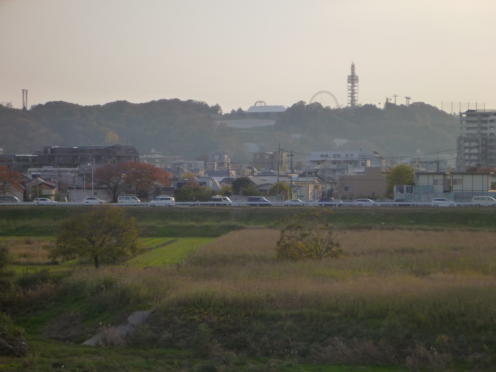
The hill to Yomiuri Land.  Does not look like much viewed from Tamagawahara-bashi

This view from the bottom of the climb.  It continues around a curve to the right.

Directions:  Cross the Tamagawa from Tokyo at Tamagawahara-bashi (the road to One-Kansen, Tsurugawa Kaido – Rte 19).  Continue across Kawasaki Kaido (Rte 9 – the major crossing just after going under the train tracks within 500 meters of the river), then turn left at the next signal onto Rte 124.  Proceed until you go under the Keio tracks and turn left into the roundabout on the South entrance of Keio Yomiuri Land Station.  In the photo above, you can see the station platform on the left edge of the photo.  Climb and descend.  Climb and descend.  Repeat until you wilt.

6 Kommentare

Eingeordnet unter Uncategorized

The Y’s Have It

Jerome and I did a „scouting“ ride on Saturday, checking out the road conditions to Yanagisawa Pass as he contemplates his idea of a 2-day year-end ride from Tokyo to Kyoto (to the extent practicable, via an interior route).  Whether this is do-able will depend on the weather conditions, to say the least.
We have gotten in a very nice series of late-year rides, the weather being far more cooperative in Kanto than it has been for our colleagues in the Positivo Espresso European chapters.  Two weeks ago there was Yamanakako (via Yamabushi Pass), then last weekend Yabitsu 2X, and now Yanagisawa.  Oh Yeah!
On December 4 mid-day, as the sun cleared the hilltops and shown down warmly on the Michi-no-Eki (rest stop) at Tabayama-Mura, Jerome’s idea of an interior ride to Kyoto seemed not such a crazy idea.

It might not seem quite as smart when trying to change a flat tire at 10 or 11PM Dec 30 on National Rte 19, somewhere along the Kisogawa in Nagano/Gifu, in sub-freezing temperatures.
In any event, on Saturday I was suffering some after-effects of a Friday evening feast, did not feel at my strongest, so we just went up to Yanagisawa, stopped for Curried Udon, turned around and I hopped the train from Oume, instead of crazier ideas such as a side trip to Kamihikawa, or maybe coming home via Imagawa Pass and a soak in the hot spring in Kosuge that we missed on Halloween morning.  Still, 170+ km and over 2000 meters of climbing for me, and home by 6PM.  Jerome, of course, rode all the way home, putting his day at 230 km or so.
The climb up Route 411 beyond Okutama-ko was … peaceful, with very little traffic, as nice as I have ever seen it.  The view from Yanagisawa toward Mt. Fuji was breathtaking.

Even more so without obstructions:

On the way up the hill, the thermometer at 1400 meters elevation reported 11 degrees C.  On the way back down, after 2PM, the sun had slipped below the edge of the Southern ridge and the valley was entirely in the shade.  The thermometer at 1400 meters showed 4 degrees.
We stopped briefly at Okutama-ko, hoping to catch a ray of sunlight … but were 15 minutes late, the sun slipping across the waters and still lighting the dam and opposite hillside.

As with last weekend, this was a nice, recreational pace.
I’ll embed the Garmin data … but one complaint.  Garmin has switched from Google Maps to an MS/Bing version.  I hope they are saving money and will pass the savings on to the consumer, since it seems to provide a noticeably inferior view on screen.
http://connect.garmin.com:80/activity/embed/58799881

3 Kommentare

Eingeordnet unter Uncategorized